

Subsite® Electronics Introduces New 2550GR Utility Locating System
Mar 14, 2016
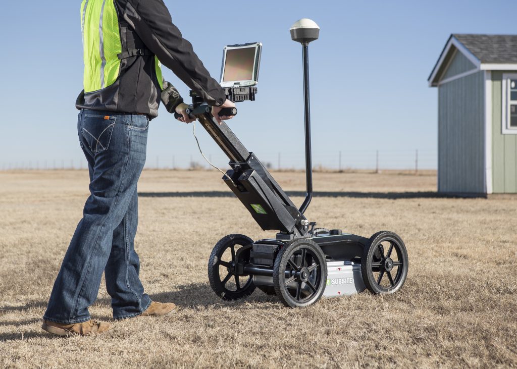
Perry, Okla., April 13, 2016 – Subsite®Electronics, a Charles Machine Works Company, introduces the 2550GR Ground Penetrating Radar System featuring a new, user-friendly Window’s-based interface that will provide operators with a number of productivity enhancing benefits. Improved software features include easier integration of GPS data and wireless connectivity that enables users to download web-based maps such as Google Earth. Building upon the proven 2450GR, the new 2550GR is ideal for locating any type of utility conduit or piping—metallic or non-metallic, including PVC—beneath soil, rock, pavement, and other surfaces.
FOR IMMEDIATE RELEASE
Perry, Okla. – Subsite® Electronics, a Charles Machine Works Company, has introduced the 2550GR Ground Penetrating Radar System featuring a new, user-friendly Window’s-based interface that will provide operators with a number of productivity enhancing benefits.
“The 2550GR offers all the same great features as our proven 2450GR,” said Matt Lumbers, product manager, utility locating systems, Subsite Electronics. “It’s ideal for locating any type of utility conduit or piping—metallic or non-metallic, including PVC—beneath soil, rock, pavement, and other surfaces. Plus, we’ve added a number of important software upgrades that will simplify operation and improve performance.”
New software for the 2550GR is designed to make users more efficient. Easy GPS connectivity allows operators to see their path and marks in real-time as they scan. A new wireless connection enables users to easily download web-based maps such as Google Earth.
Other software enhancements include an “assisted grid” capability that allows users to grid locations digitally, eliminating the time-consuming task of physically painting the ground.
A new one-touch recalibration button lets operators transition from one scanning surface to another quickly and easily, while the earth-engaged antenna provides better contact on uneven terrain and reduces signal loss.
“We listened to users in the field and have been able to improve the operator experience with significant software upgrades,” Lumbers said.
The 2550GR locates both metallic and non-metallic pipes and cables to allow one-pass locates at depths of up to 19.7 feet (6 m), depending on soil conditions and antenna selection. A 5.6 mph (9 km/h) survey speed and digitally controlled radar allow the 2550GR to provide fast, clear images.
In addition to utility mapping efforts, the 2550GR’s advanced locating capability makes it ideal for a wide range of other applications including void and sinkhole detection, concrete detection, and locating underground storage tanks.
For more information on this product and Subsite® Electronics, visit www.subsite.com or any of our social media channels – Facebook, Flickr, Twitter, Google+, LinkedIn and YouTube. You can contact us at info@subsite.com or 800-846-2713.